|
Rails to Trails
Existing and Potential Rail-to-Trail Projects in Central Alberta
There are at least two potential abandoned railway rights of way in Central
Alberta that could one day become trails.
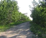
One is the former Alberta Central Railway (CPR) alignment between
Red Deer and Sylvan Lake and perhaps to Benalto, most of which is owned
by Red Deer County with the Town of Sylvan Lake owning the portion
within its boundaries. There are some serious challenges to be
addressed, including the rehabilitation of the historic Mintlaw trestle
and the crossing of the 4-lane Highway 11 expressway.
See
Proposed Forth/Tuttle-Mintlaw-Sylvan Lake ACR
Linear Park
Powerpoint Slide Show:
History of the ACR & Mintlaw Trestle and
Future Trails
(presented at FJHS AGM Oct. 2012)
The other is a proposed multi-use trail between Rocky Mountain House and Nordegg along the former
Canadian National Railways Brazeau subdivision right of way abandoned in 1955 and now owned by
Clearwater County. There are several challenges here as well
including the rehabilitation of several bridges and the multiple
crossings of Highway 11.
A series of linear parks is actively being pursued in communities
along the 99-mile former Canadian National Railways Stettler
subdivision, now owned by the East Central Alberta Heritage Society
between Edberg and Morrin through Meeting Creek, Donalda, Red
Willow, Stettler, Big Valley and Rowley. The section between
Stettler and Big Valley is currently operating as the Alberta
Prairie tourist railway with an extension being added north to Red
Willow and eventually to Donalda.
Another possible linear park could run along a portion of the
abandoned Canadian Pacific Railway Langdon and Acme subdivisions
between Irricana and Torrington. The line was donated to the Trans
Canada Trail Foundation and is being managed by Alberta TrailNet.
The Alberta 2005 Centennial Railway Museum Society is creating a
rail museum on the former right of way at Beiseker. Currently, a
trail is proposed between Beiseker and Irricana.
In Red Deer, the former Canadian Pacific Railway bridge has already been
converted into part of the Waskasoo Park and Trans Canada trail systems.
The connection between that bridge and the historic CPR station
could become part of a future trail link with the downtown.
Rails to trails projects have been very successful across North America
including the Kettle Valley Railway trail in British Columbia and the
Iron Horse Trail northeast of Edmonton.
Kettle Valley Rail Trail
The 455-km Kettle Valley Rail Trail in the Thompson Okanagan region
of British Columbia is one of the most well-known and scenic trails
in Canada. The KVR, built between 1910 and 1916 and operated by the
Canadian Pacific Railway, was decommissioned in segments between
1962 and 1978. The original line in Myra Canyon had 19 timber
bridges. Two were later earth-filled and two other reconstructed
with steel. The most spectacular steel bridge (West Fork Canyon
Creek) near Kelowna on a 12 degree curve is 721 feet long and 182
feet high. Another spectacular bridge (Trout Creek) near Summerland,
is 241 feet high and is shared with a tourist steam train. Access to the B.C. government-owned trail, originally
opened in 1995, is available at several points along the former rail
line including Princeton, Summerland, Penticton, Midway and Grand
Forks. A major forest fire destroyed 12 of the timber trestles in
Myra Canyon in 2003 but the bridges were reconstructed and the trail
re-opened in 2008. It is now part of the Trans Canada Trail system
and has around 50,000 visitors per year resulting in a significant
benefit to the tourism industry of the region.
Iron Horse Trail
In September 1999, many interested citizens from Smoky Lake to
Heinsburg northeast of Edmonton joined together to form the
Riverland Recreational Trail Society to build and operate a trail
from Fort Saskatchewan to the Saskatchewan border. Ten
municipalities formed a Part Nine company to own and administer a
260-km multi-use trail consisting of portions of the former Canadian
National Railway Coronado and Bonnyville subdivisions. This line
runs directly through the small towns of the area including
Weskatenau, Smoky Lake,
Vilna, Ashmont, St. Paul, Elk Point and Heinsburg as well as Grand
Centre, Bonnyville and Glendon. CN had abandoned the 34-km Elk Point
to Heinsburg line in 1980 and abandoned the remainder of the
corridor in 1999. The route was once part of the historic Carlton
trail in the 1700s. The official opening of the Iron
Horse Trail was in 2003 and in the following year became part of the
Trans Canada Trail connecting with many local trails. The most
spectacular bridge along the trail is the Beaver River Bridge near
Grand Centre at a length of 1,485 feet.
Other significant former railway bridges on the Trans Canada Trail
include the 3,000-foot-long SkyTrail former CPR deck truss
bridge at Outlook, Saskatchewan (Canada's longest pedestrian
bridge) and the 617-foot-long and 145-foot-high former CNR wood
trestle at Kinsol, British Columbia which last supported a
train in 1979.
Benefits of Rails to Trails
- safe pedestrian and bicycle transportation corridor
- health and fitness
- conservation and environmental preservation
- potential for rural tourism
- heritage preservation
- economical recreation
- existing trailbed and gentle grades
- interesting scenery
- experience nature and rural lifestyle
- community identity
- minimal maintenance
- increased quality of life
|